Anticipating rain with GPS signals
It sounds a bit strange at first: the same satellite signals used for positioning can also tell us something about rain.
When GNSS signals travel from a satellite to a receiver on the ground, they are delayed by the atmosphere. Part of that delay comes from water vapour (see one of my old postst here)
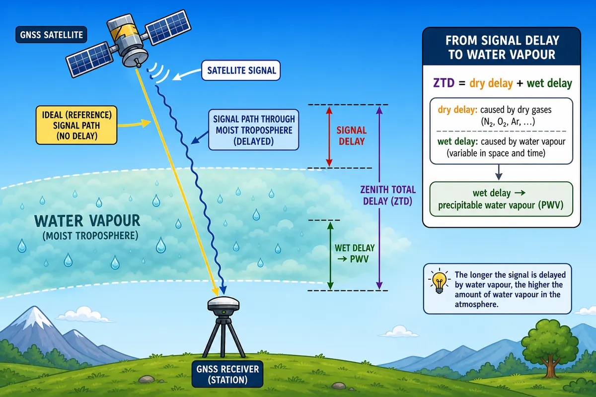
If the atmosphere above a station becomes rapidly moister before a convective event, the GNSS-derived precipitable water vapour (PWV) or zenith total delay (ZTD) often rises before the rain starts.
That does not mean there is one clean universal correlation between "high PWV" and "rain". The literature suggests something more interesting: the useful signal is often in the change of PWV or ZTD, not just in the absolute value.
A typical pre-rain PWV jump
This is the main pattern that appears in the data:
- moisture builds up,
- PWV rises in pulses,
- a local crest appears,
- then the heaviest rain follows some minutes later.
In that sense, GNSS-derived PWV/ZTD is less a "rain detector" and more a moisture-buildup detector.
One of the clearest examples comes from Sapucci et al. (2018), who looked at 1-minute GPS-PWV before intense rainfall events in Brazil. The figure below shows a strong rise in PWV before a heavy storm, followed by a crest and then the precipitation peak.
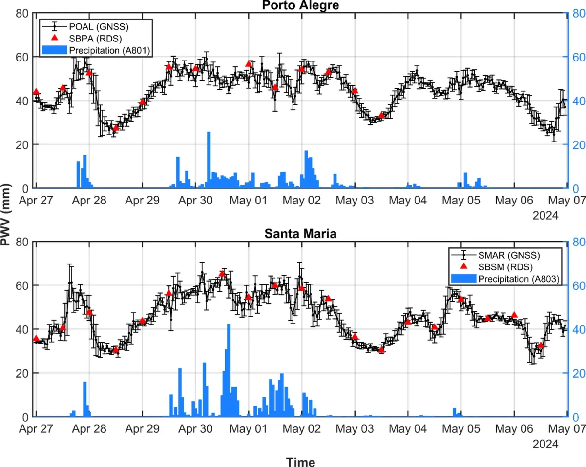
Re-drawing the cartoon above to represent the phenomenon just described
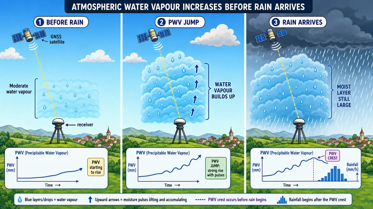
Note that, although the situation depicted above is physically plausible this is only a conceptual sketch of some intense convective cases. PWV can rise because of moisture advection, diurnal boundary-layer growth, sea breeze, frontal approach, or humid but capped air. Many of those rises will not produce rain at the station.